Trail Maps
Westminster Hills Off-Leash Dog Park
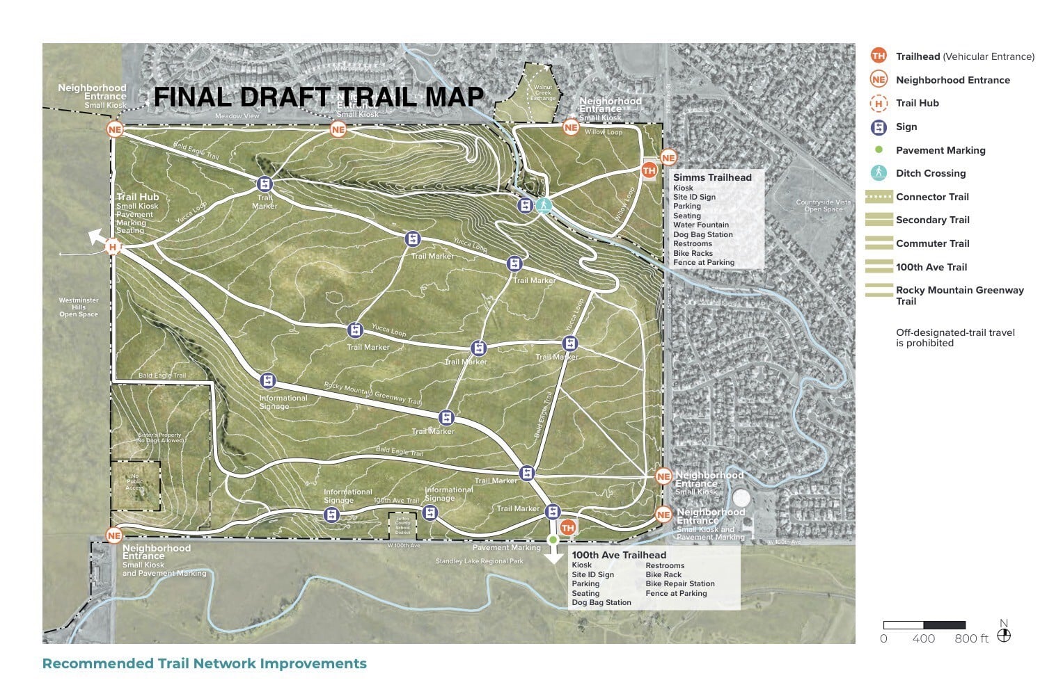
The Guardians have been involved in a Management Plan project with the City and other community members to formulate a good, usable trail map for the dog park. We all know how it's currently being used, but the actual map on the City's website is very minimal and never reflected actual usage. The Guardians proposed a map and there was general consensus that the Guardian's proposed map more accurately reflected actual use at the park. The map shown here is the Final Draft from the Management Plan committee (👍🏻). There are a few proposed reroutes on the hills for erosion control and some social trail reroutes, but overall a good mix of short/long/improved/unimproved trails! Let us know what you think! The final plan will be presented to City Council at the end of the year. After that, changes/improvements will be made as funds are available. Stay tuned for parking lot and entrance plans, there's more to come!
Enjoy your time at the park!
JPEG Trail Map